
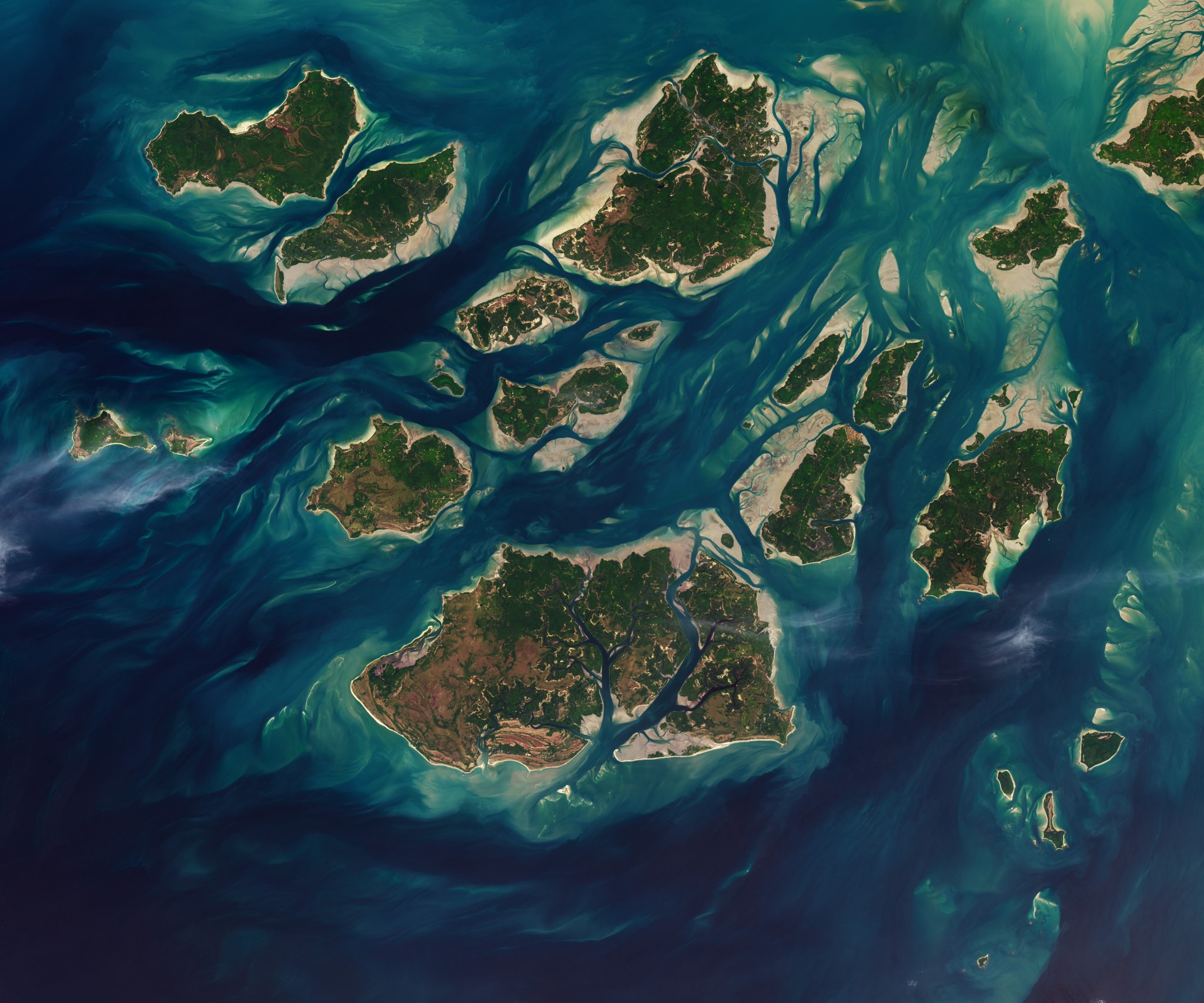
Twice each day, tides ebb and flow through a maze of sandy channels, mudflats, and mangrove forests that flank the 88 islands and islets of Guinea-Bissau’s Bijagós Archipelago (Arquipélago dos Bijagós in Portuguese). Seen from above in this image from Nov. 28, 2025, the process leads to stark changes to the landscape: around low tide, intertidal mudflats and sandflats emerge from the sea, causing islands to grow significantly before shrinking again hours later.
Learn more about the region and its wildlife.
Text credit: Adam Voiland
Image credit: NASA/Lauren Dauphin, USGS
Hence then, the article about guinea bissau tidal waters was published today ( ) and is available on NASA ( Middle East ) The editorial team at PressBee has edited and verified it, and it may have been modified, fully republished, or quoted. You can read and follow the updates of this news or article from its original source.
Read More Details
Finally We wish PressBee provided you with enough information of ( Guinea-Bissau Tidal Waters )


Also on site :
- HDFC Bank Limited Sued for Securities Law Violations - Contact the DJS Law Group to Discuss Your Rights - HDB
- Quote of the Day: Cleanthes Worked Night Shifts as a Water Carrier to Study Philosophy by Day. Then He Took Over Ancient Greece’s Leading Stoic School
- Anne Hathaway Will Campaign This Awards Season in an Unexpected Category, 13 Years After Her Oscar Win