
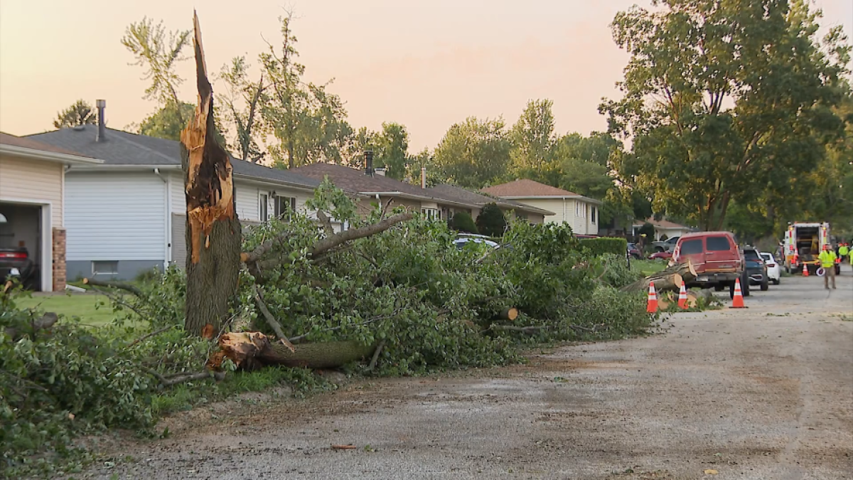
Tuesday’s storms powered through the Chicago area at a unusual pace, bringing with them multiple tornado spin-ups and straight line winds that reached up to 100 mph.
The Storm Prediction Center preliminarily determined Tuesday’s destructive and “catastrophic” system to be a derecho, with a path that extended from Iowa into Illinois, Indiana, southeastern Ohio, and eastern Kentucky.
So what does that mean?
What is a derecho?
According to the National Weather Service, a derecho is a widespread, long-lived wind storm associated with rapidly moving showers and thunderstorms.
A derecho can cause wind speeds typically seen in tornadoes, but does so in one direction along a “straight swath,” according to the NWS.
To be defined as a “derecho,” the wind damage swath must extend more than 240 miles and must include wind gusts of at least 58 miles per hour along its length.
Having winds of up to 100 mph would make Tuesday’s system among the stronger derechos.
The mass of straight-line winds can cause immense damage, destroy buildings, level farm fields and leave thousands of residents without electricity.
How common are they?
Illinois sits along a path where derechos are among the most frequent.
According to the NWS, the state on average sees around one derecho every year.
According to data, derechos are most common between May and August, when 70% of all derechos occur.
How do they form?
The NWS states that derechos develop with a so-called “bow echo.” Thunderstorms experience a phenomenon called “updrafts” early in their formation, when warm surface air rises until condensation begins forming, ultimately transitioning to rain.
This forces cool air toward the ground on the back end of a storm, which has the effect of generating strong winds near the ground, according to researchers at South Dakota State University.
As the line of storms strengthens, updrafts continue on the edge of the storm and the mass of rain-cooled air at the surface expands the storm horizontally, pushing it forward more quickly and generating higher wind speeds. In certain instances, those winds sustain for hundreds of miles, and are considered derechos.
“A typical derecho consists of numerous downburst clusters that are, in turn, composed of many smaller downbursts, microbursts, and burst swaths,” the Storm Prediction Center reported.
It’s also not uncommon for both tornadoes and derechos to form at the same time.
“This is particularly so with serial derechos associated with strong, migratory low pressure systems. The tornadoes may occur with isolated supercells (rotating thunderstorms) ahead of the derecho producing squall line, or they may develop from storms within the squall line itself,” the Storm Prediction Center notes.
Hence then, the article about what is a derecho what to know after tuesday s destructive storms damaging winds was published today ( ) and is available on NBC Chicago ( Middle East ) The editorial team at PressBee has edited and verified it, and it may have been modified, fully republished, or quoted. You can read and follow the updates of this news or article from its original source.
Read More Details
Finally We wish PressBee provided you with enough information of ( What is a derecho? What to know after Tuesday's destructive storms, damaging winds )


Also on site :
- Ivanka Trump Shares Rare Family Photos From Her Grandmother’s 100th Birthday Celebration, With Special Wishes From These Unexpected Stars
- Pedro Pascal Was Surprised Tony Gilroy Made ‘Behemoth!’ “So Intimate And Healing”: “I Thought You Were Gonna Be Mean”
- Dolly Parton’s Nephew, Accused of ‘Terrorizing Conduct,’ Requests Delay in Restraining Order Fight to Find Lawyer